
| iMereb Business Management Solutions, Information Technology, Mapping & Cartography and Image Analysis |
| | | |
EXPERTISE / IMAGE ANALYSIS / AREA AND CONDITION / ZAMBEZI RIVER |
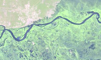
The Zambezi River which forms a portion of the
border between Zambia and Namibia. This image
shows the higher water levels on March 31, 2013
and for comparison the dry season on August 25,
2012. The comparison between the two images
show this huge difference in the surrounding
floodplains.
The larger channels are not the only thing you see a
difference in but the browns and tans of dried
vegetation and burn scars prevail in the dry season,
green plant life is revived in the wet season. The
water-loving floodplain grasses surrounding the
Zambezi River depend on annual floods and
seasonal rainfall that is relatively abundant
compared to much drier areas to the west.
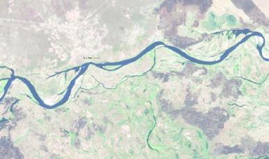